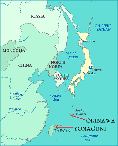
OKINAWA
Okinawa is the southernmost prefecture of Japan. Its capital, Naha, is in the south of the largest and most populous island, Okinawa Island, a 2hr 15min flight southwest of Tokyo. The mile long Kokusai-dōri (International Avenue) has many shops, restaurants and bars. The large, covered Heiwa Dori Arcade / Makishi Public Market is filled with fresh fish, meat, produce stands, restaurants, tourist shops and liquor stores.
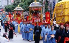
History The Ryūkyū Kingdom ruled most of the Ryukyu islands between the 15th and 19th centuries and was a prosperous trading nation due to it's tributary relationship with Ming Dynasty China. During this period many Gusukus (castles) were built. The Kingdom was invaded by Japan in 1609 and found itself in a period of dual subordination to Japan and China until 1872 when the Japanese government abolished the Kingdom and renamed it Ryukyu Han (Ryukyu Fief). In 1879, Japan annexed the islands and Ryukyu Han became Okinawa Prefecture.
During WWII, the Allies planned to use Okinawa as a base for air operations during their invasion of the Japanese mainland. Okinawa was under US administration from the end of WWII until 1972 when the US government returned the islands to Japanese administration. The US has maintained a large military presence in Okinawa, leading to controversy and some resentment.
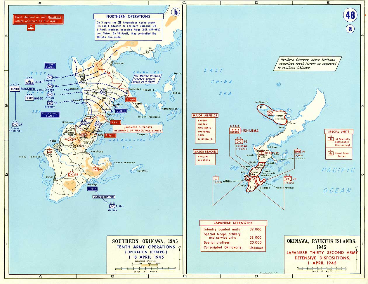
The 82 day long Battle of Okinawa (April - June 1945) was the largest amphibious assault and one of the most intense battles in the Pacific war. A quarter of Okinawa's civilian population was lost in the battle. For more information on this major battle go to this link: http://www.historynet.com/battle-of-okinawa-operation-iceberg.htm
Click the map for an enlarged view of the first week of Operation Iceberg April 1st - 8th, 1945:
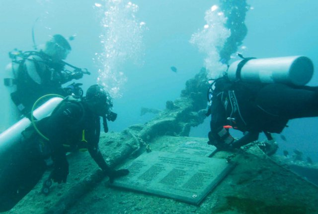
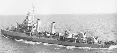
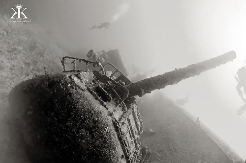
USS EMMONS - Sunk by Kamikaze Aircraft at Okinawa and is a sobering memorial...
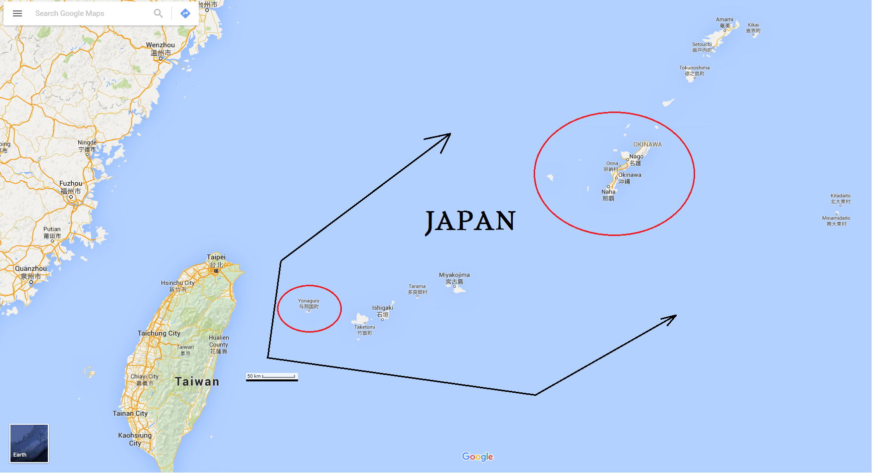
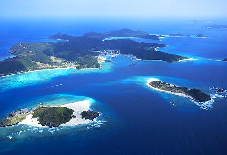
The Okinawa Prefecture encompasses the southern two thirds of the Ryukyu Archipelago which consists of approximately 160 islands (48 of which are inhabited) of varying sizes stretching for 1,000 kilometres from east to west and 400 kilometres from north to south in between the Philippine Sea and the East China Sea - from Kyūshū (in the southwest of Japan) all the way to Taiwan.
Okinawa is a place of natural beauty with white sand beaches, enticing clear blue water and vibrant coral reefs. Old-growth forests untouched since ancient times and mangrove jungles are home to precious rare animals and plants such as the Iriomote cat, one of the world's rarest and most endangered cat species.
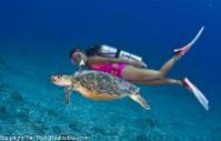
SCUBA DIVING
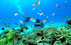
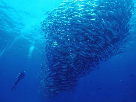
Okinawa's surrounding waters are fed by the warm Kuroshio current running north from the Philippines, bringing a huge variety of marine life to the islands. The warm subtropical climate facilitates diving year round. Species of reef fish, marine mammals and sea turtles that inhabit Okinawan waters total more than 1,000, while reef building corals exceed 200, making Okinawa amongst the larger coral habitats in the world. The underwater topography varies between the islands.
There are over 80 dive sites around Okinawa and the surrounding islands. Visibility can sometimes reach over 40 metres and currents can be strong at some sites. The Kerama Islands have some of the best scuba diving and snorkeling options.
OKINAWA ISLAND - WEST COAST
The main island has dive sites in the north, south and mainly on the western side where there is a drop off. Some sites are beach dives but most are accessible by boat.
Blue Cave (Maeda)
Easily accessible by snorkelers and divers. This famous, half submerged cave is named for the blue water created by the sunlight reflecting off the sandy white bottom. Find rock shrimp, pipefish and moray eels inside.
Manza Dream Hole (Onna)
A hole in the reef with the entrance at 5 metres before opening onto a reef wall at 26 metres. A wall of fish surrounds the exit. For advanced divers.
Sunabe Sea Wall
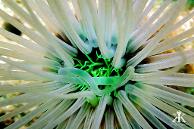
A beach entry dive over a rich soft coral reef home to anemone fish, damsel fish, cuttlefish and sea snakes. Depth: 5 - 25 metres.
USS Emmons
A 90 metre long WWII shipwreck destroyed in an attack by Japanese kamikaze aircraft and reportedly sunk by the US to avoid the danger of drifting towards Japanese territory. Best accessed during summer months.
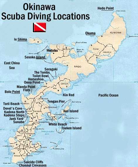
CHIBISHI ISLANDS
Three small uninhabited islands located approx 30 minutes southwest of the main island. Features some drift dives and drop offs, green sea turtles, reef sharks and schools of tropical reef fish.
Labyrinth (Kamiyama Island)
A large dive area where you could easily lose your way amongst the maze of rock formations, white sand rivers, finger reefs, swim throughs and good visibility.

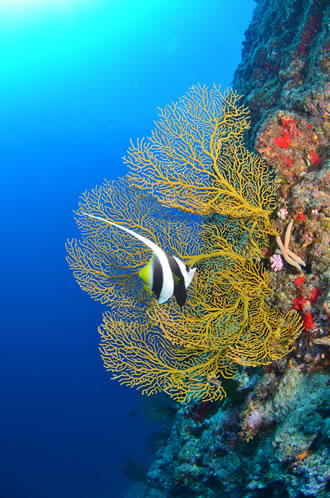
KERAMA ISLANDS
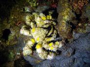
A 1 hour boat ride from the main island, a group of 20 islands famous for their stunningly blue waters and clear visibility, unparalleled coral reefs and raw limestone rock formations. Drift dives take you over a giant sea fan paradise and multi-hued schools of fish.
Kuroshima Twin Rocks
The swirling current around the two pinnacles covered in sea fans, hard and soft corals brings dogtooth tuna, giant trevally, sharks, eagle rays and huge schools of fusiliers and anthias.
Ugan
"man rock" is one of the best sites in the Keramas for advanced divers. The steep cliffside of Ugan drops to 40 metres in some place. Riding the current around the rock, you may be able to spot several crevices with lots of lionfish in them. Large schools of pyramid butterfly fish, mountains of orange coral cups, blue fusiliers, and colourful anthias dart on the edge of the drop off and along the wall. Sightings of dogtooth tuna, napoleon wrasse, turtles and sharks increase with the current.
Arari (Tokishiki Island)
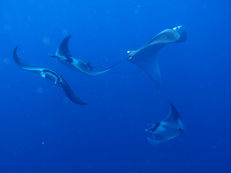
Has sea fans up to 2 metres in diameter. Often has visiting manta rays.
YONAGUNI
Click on the image to enlarge:
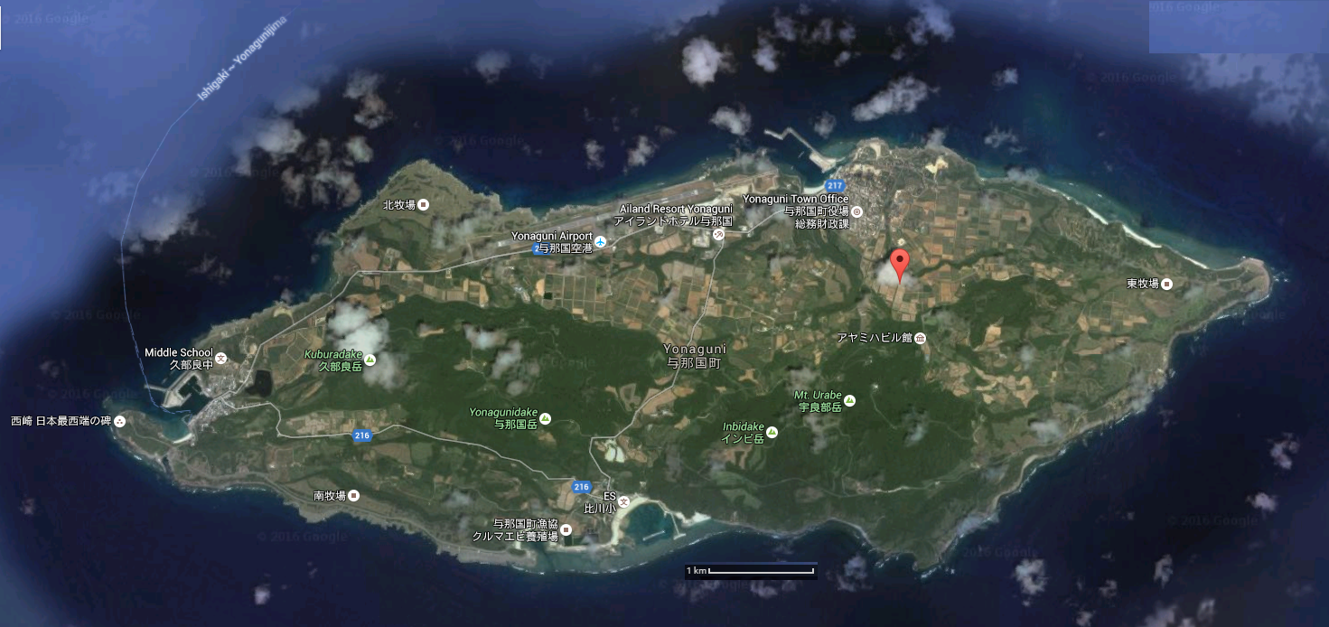
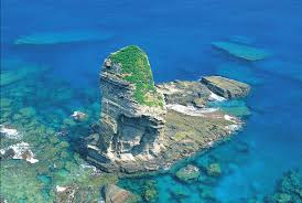
Yonaguni is a small, remote, untouched island, a 2 hour flight to the west of Naha (Okinawa's capital). It is one of the Yaeyama Islands in the prefecture of Okinawa. Less than 2,000 people inhabit the island. The main residential area is the town of Sonai, situated on the north coast near the airport.
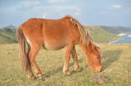
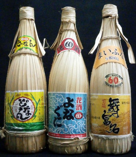
Yonaguni is known in Japan for the hanazake, a 120-proof rice-based distilled beverage (awamori) produced only on the island. The island is also the only natural habitat of a distinctive horse breed, the Yonaguni horse.
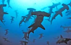
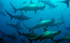
In the diving world, Yonaguni is known for the chance to dive with hammerhead sharks during the winter months as well as its mysterious Underwater Monument discovered in 1986 by Kihachiro Aratake. The waters around Yonaguni Jima are said to be the third clearest in the world.
Scuba Diving in Yonaguni
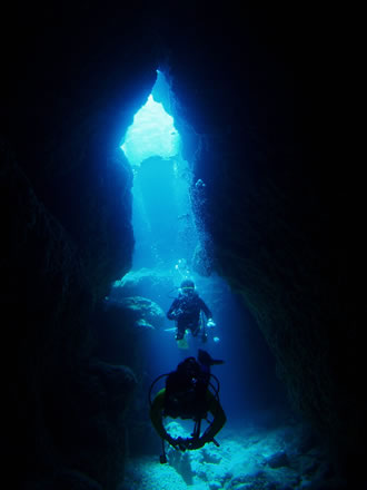
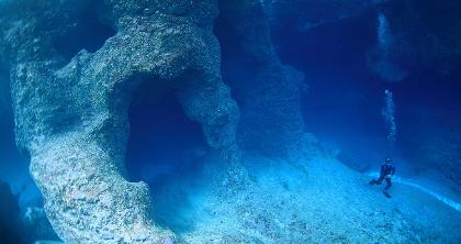
Most dives around Yonaguni are drift dives and the currents can be quite strong. Throughout the year there are schools of big eye trevally, barracuda, dogtooth tuna, turtles, large cuttlefish and more. Many large rock formations, caverns and tunnels provide plenty of areas for exploration.
The 70+ dive sites around Yonaguni Jima provide fantastic diving experiences for advanced divers and beginners alike with excellent visibility, plus the thrill of seeing the mysterious Underwater Monument and encountering schools of hammerheads. With lots of beautiful coral, interesting rock formations and an abundance of subtropical marine life around the islands, Yonaguni could be the best kept diving secret in the world!
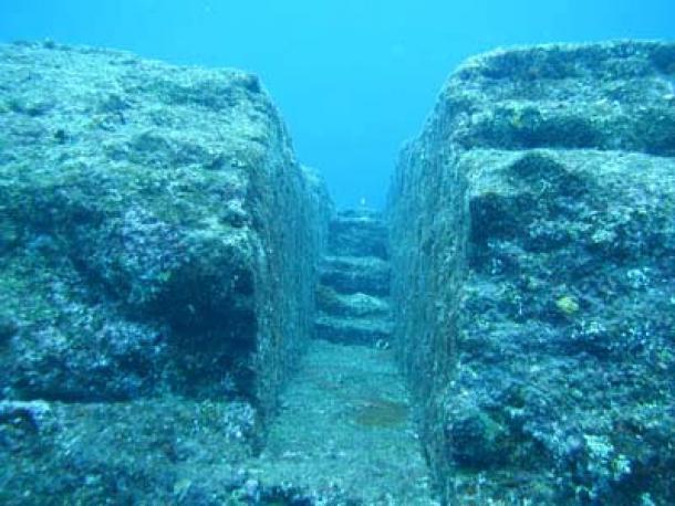
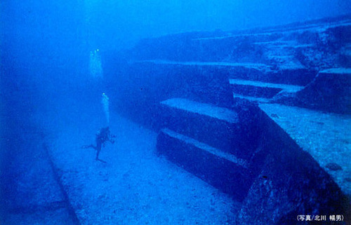
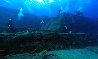
Yonaguni Monument
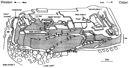
Yonaguni's unique attraction for both archaeologists and divers alike are the mysterious underwater ruins which lie off the south coast of the island. Discovered in 1986 by then divemaster, Mr Kihachiro Aratake when he was scouting the area for new hammerhead schooling sites, the megalith structures have sparked much debate as to whether they were completely naturally formed, were naturally formed then modified by man or are man-made structures created by an ancient civilisation dating back to the last Ice Age (around 10,000 BC) which would make the Monument the oldest man-made artefact on earth, pre-dating the pyramids in Egypt.
Once you have seen the Monument with your own eyes, it is hard to believe that they were formed by completely natural processes. Key features include an archway entrance; twin megaliths standing perfectly side by side; a staircase; the main monument measuring some 100 metres long x 50 metres wide and 25 metres tall, with perfectly carved perpendicular terracing; a triangular shaped pool with a drainage channel; decorative rock carvings; a formation which looks distinctly like a face; and evidence of a cobbled loop road around the structures.
Could this be the mythical lost continent of Mu?
The currents around Yonaguni Monument can be ferocious which can be a challenge for newer divers.